![]()
GNSS Reflectometry on Lake Michigan
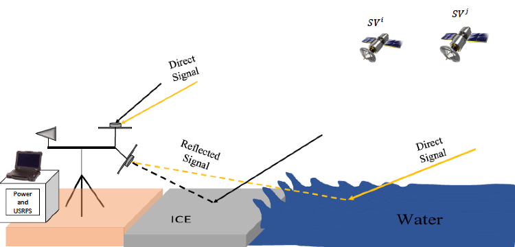
We are conducting the first study using GNSS-R to monitor and distinguish liquid freshwater from lake ice, paving the way for routine remote sensing of seasonal ice formation. A ground-based experiment will be carried out on the Lake Michigan shoreline, the first documented study of lake ice and freshwater surface properties using GNSS reflectometry (GNSS-R).
This project will advance novel methods of remotely sensing water and ice coverage on freshwater surfaces using reflected Global Navigation Satellite System (GNSS) signals. GNSS-R measures delay and distortion of the reflected signal, yielding information about the surface, primarily roughness. Analysis of the received power and its distribution can be used to monitor lake ice and freshwater, at higher resolutions than ever before.
Click here to see the calendar of forecast weather conditions and forecast number of reflection points within 100 m of the data collection site.
This project is supported by NASA grant NNX15AV01G for period 11/2015 - 10/2019.
Image: